First-responder delivery drone
An aircraft delivering a small payload to a street address, autonomously, from any computer over a cellular link with video and telemetry, in 2021.
A street address is input using the Google maps interface, then the aircraft flies to it autonomously, delivering live video and telemetry back to the ground station.
the problem
We need autonomous drones which can deliver small payloads (like EpiPens) to street addresses for first responders, and we need them to be deployable from any computer while being monitored through live video and telemetry.
what I did
We built and tested 4 subystems: MAVLink telemetry including arm and disarm, address-to-coordinate resolution and autonomous navigation, a cellular link, and live video to the ground station.
what happened
A drone deployable to an address from any computer over a cellular link, with live video and telemetry, flown autonomously 4 times.
Networking Architecture
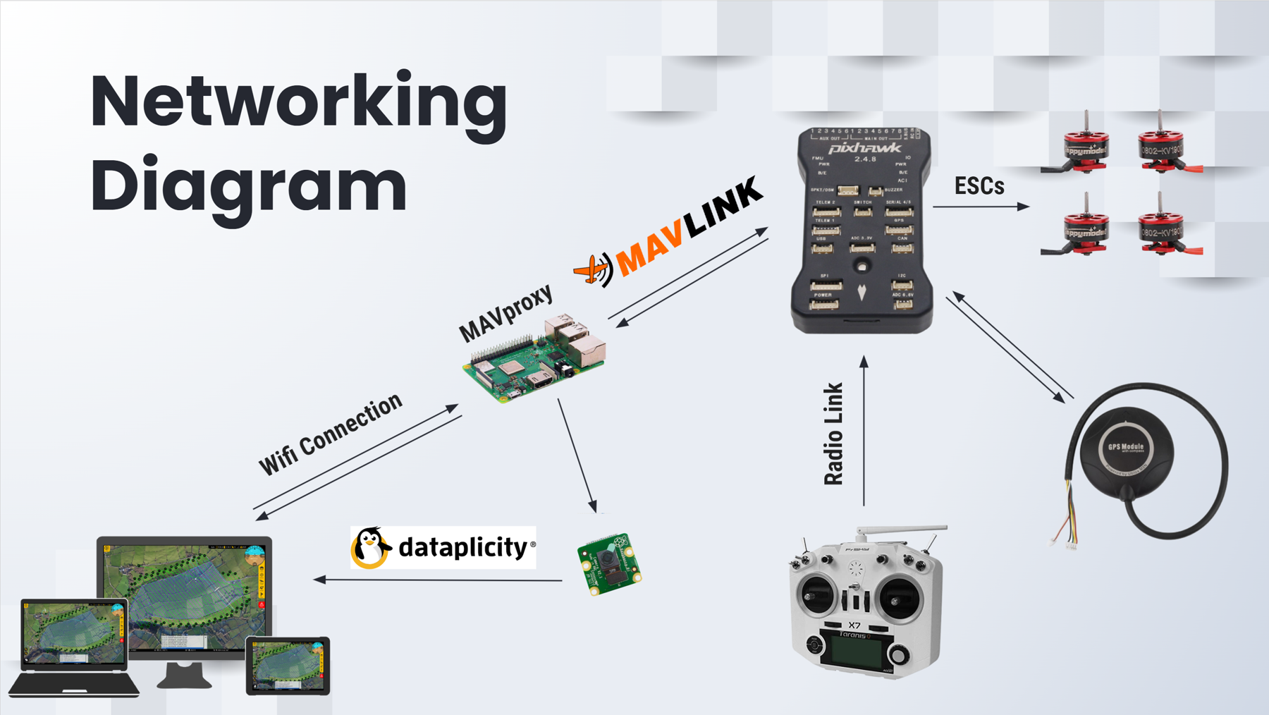
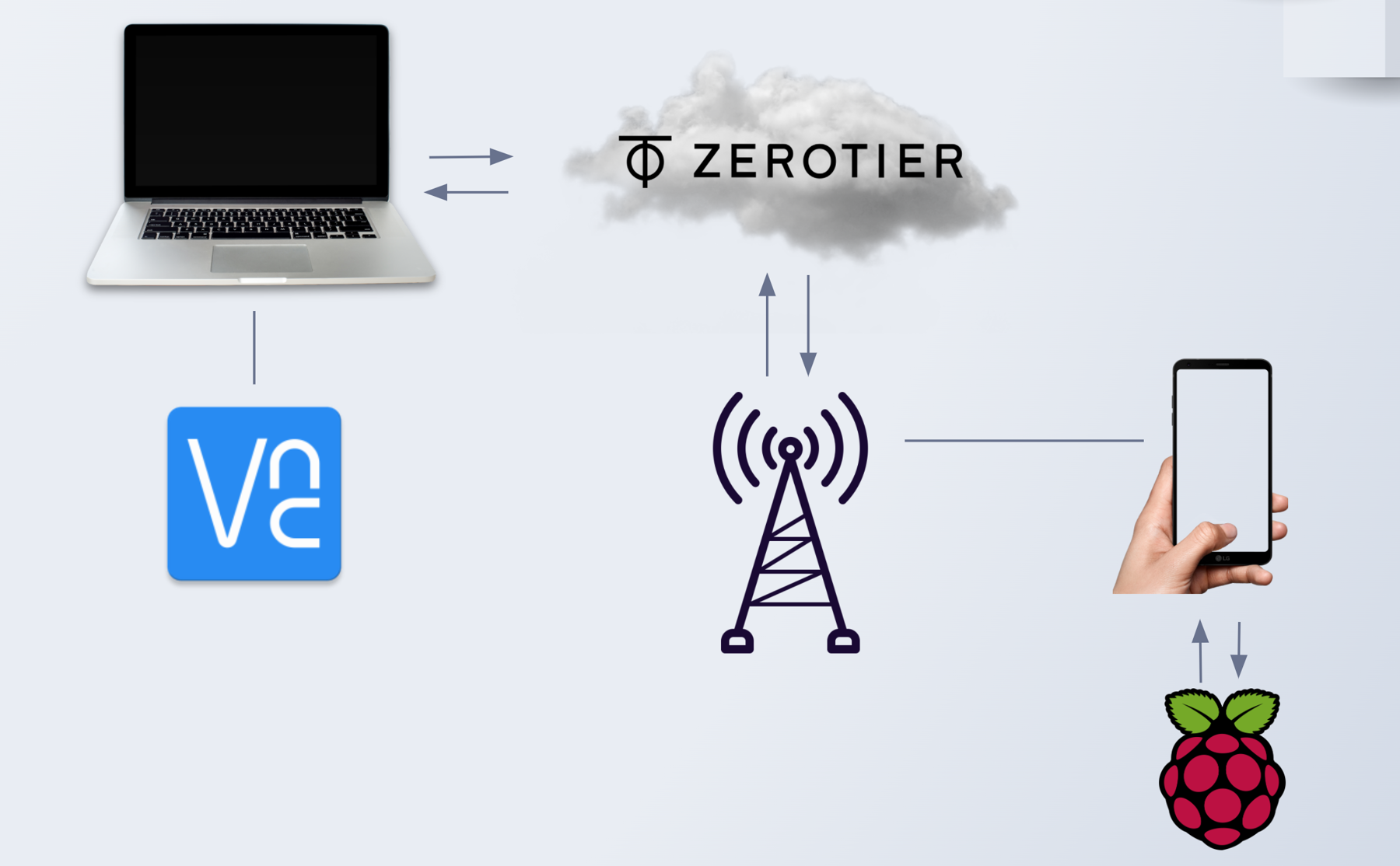
The aircraft is a Pixhawk and the ground station is a laptop, and they were never connected to the same network. The networking diagram below exists to get them to talk to each other. A Raspberry Pi rides on the airframe that runs MAVProxy, which takes MAVLink off the serial link to the Pixhawk and broadcasts it to a cellular connection. The Pi and the laptop both join a ZeroTier virtual network so each holds a fixed address regardless of their physical locations, which is what makes the ground station able to find an aircraft that is not on the same network. For live video, we struggled with carrier firewalling, so we used Dataplicity to tunnel the Pi's camera feed to the laptop using a TCP connection.
More information
This slide deck contains extra information about the project, and was part of a presentation given to industry professionals.


